
Sydney Is Now Home to an 80-Kilometre Coastal Walking Track Stretching from Bondi to Manly
The epic — and super-scenic — trek wanders past secluded coves, spectacular views, bushland, clifftops, and landmarks such as the Sydney Opera House and the Sydney Harbour Bridge.
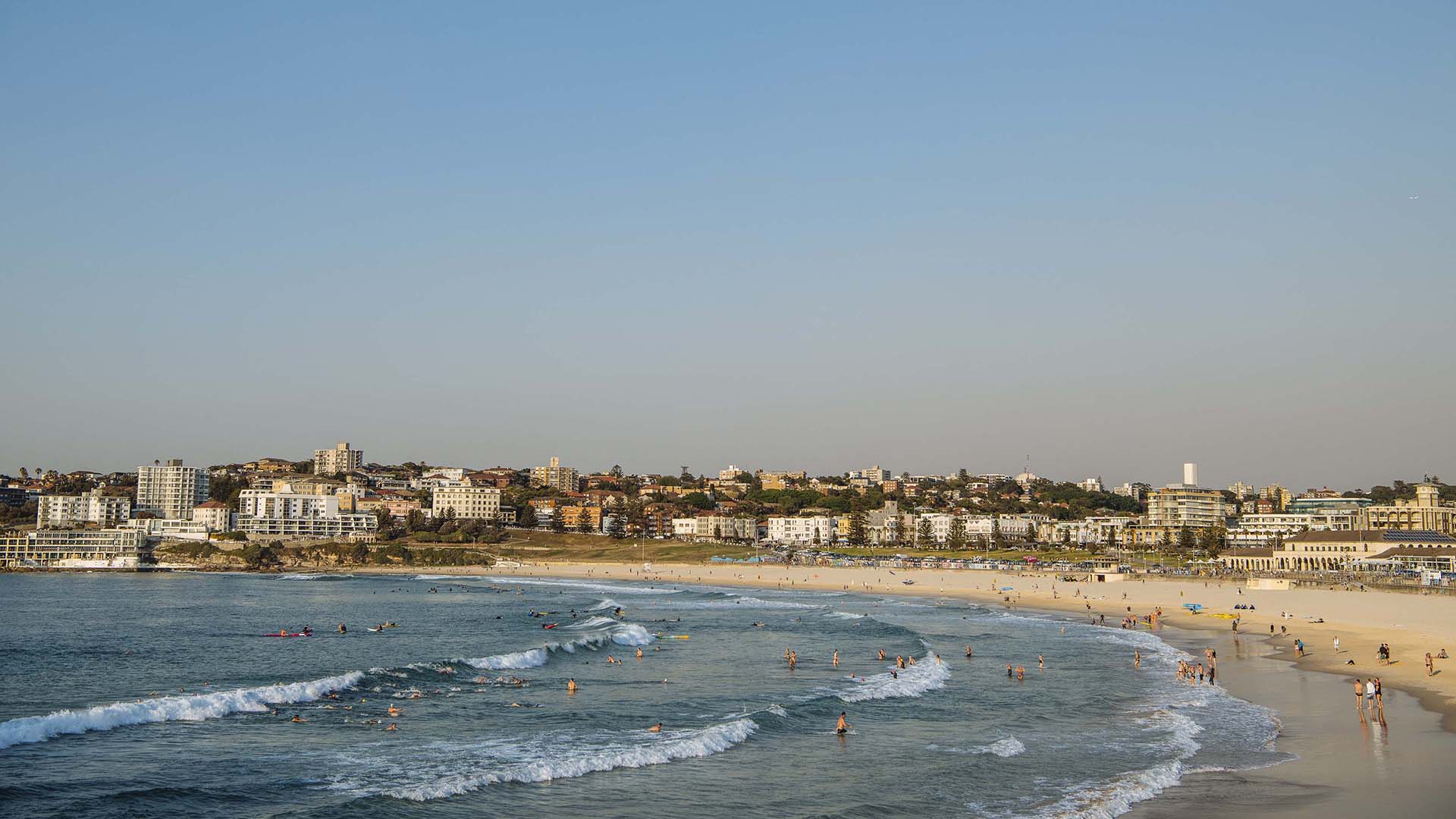
Fancy soaking in Sydney's expansive coastal surroundings while putting one foot in front of the other? Then head to the city's newest attraction. Stretching between the two titular beaches, the just-launched Bondi to Manly Walk spans 80 kilometres along the east coast and harbour foreshore — connecting the existing tracks in the area into one epic, super-scenic seaside trek.
First announced in November 2018 and now open for Sydneysiders to stroll along, B2MW meanders past all of the expected highlights; think secluded coves, spectacular views, bushland, clifftops, and landmarks such as the Sydney Opera House and the Sydney Harbour Bridge. As the name makes plain, it starts and ends at Bondi and Manly beaches, but there's plenty to see in-between. You'll also wander everywhere from the Hornby Lighthouse and Mrs Macquarie's Chair to the Royal Botanic Garden Sydney and Curlew Camp.
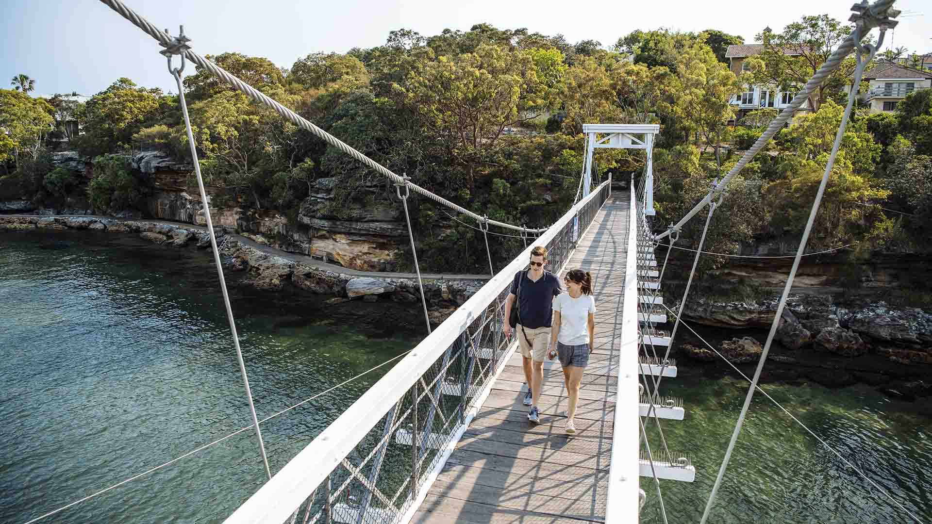
Specifically winding through Bondi, Watsons Bay, Rose Bay, Darling Point and Kirribilli, past Taronga Zoo, over to Spit Bridge, then through Manly Wharf to Manly Beach, the track combines a host of already-popular trails. Stroll along the South Head Heritage Trail, Green Point Walking Track, Hermitage Foreshore Track, Bradleys Head Walk and Georges Heights Walk, then head through the Manly Scenic Walkway, North Head Sanctuary, Australian Memorial Walk and Fairfax Track.
Emphasising the people of the Eora Nation, the traditional custodians of the land through which the B2MW travels, the trail also journeys past significant Indigenous sites such as an Aboriginal People's midden between Fisher Bay and Sandy Bay, Aboriginal engravings at Grotto Point, and the ancestral reburial site and rock art at Reef Beach.
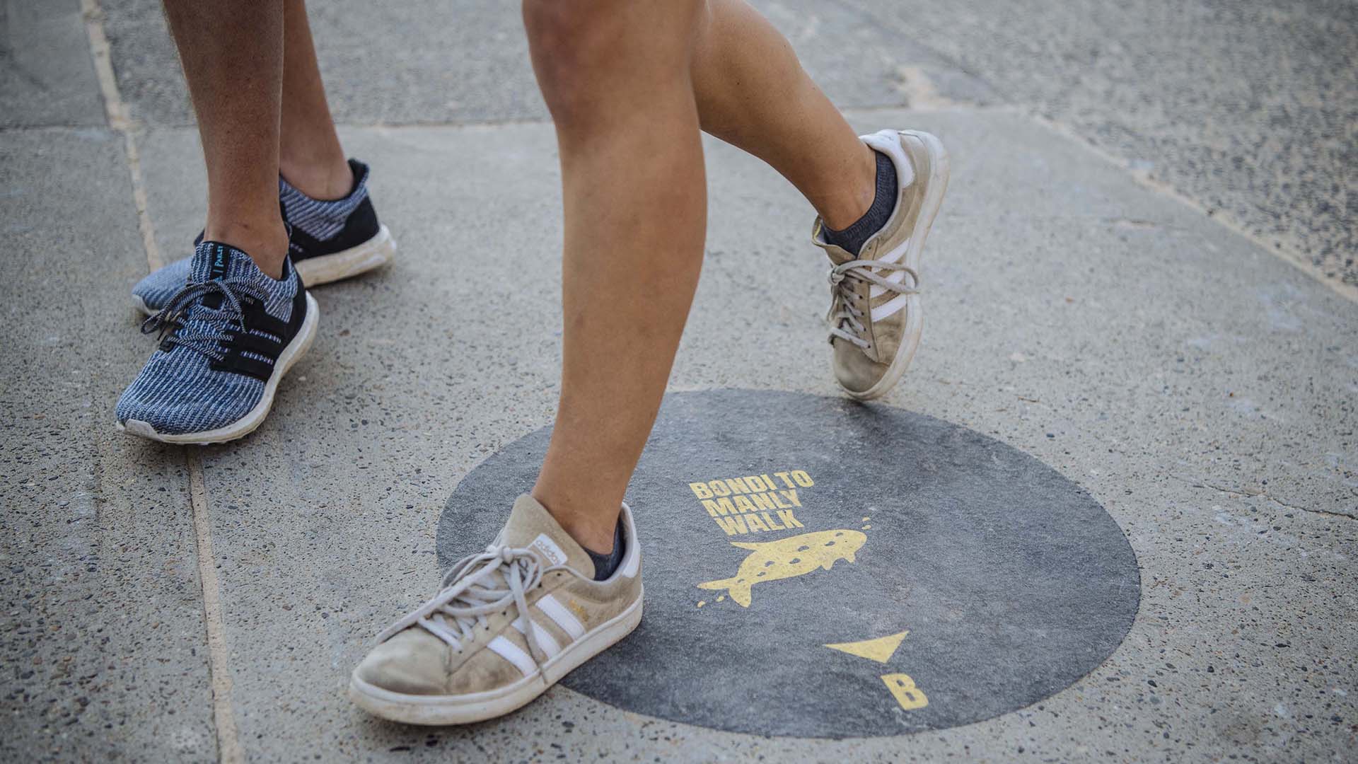
Plus, while you're moseying, you'll follow 350 Aboriginal Whale Symbol signs along the mega trail's lengthy expanse — with an app also available to help you plan and track your walk.
Sixty kilometres of the massive track runs over public land, including bushwalking paths, while the other 20 kilometres takes walkers along footpaths — with the trek coming about after considerable co-operation between the relevant local, state and federal government bodies.
And if you're wondering how long it takes, suggested itineraries split the walk into four, five and seven-day routes, although you can obviously make the journey however you see fit.
The Bondi to Manly Walk is now open. For more information, visit the walk's website.
Images: Destination NSW.


