Overview
There are few areas on earth that Google Street View can't venture — and now one place in space as well. In the latest addition to their popular Google Maps feature, the technology giant has added the International Space Station to its list of destinations. Clearly charting the planet humanity walks on just wasn't enough.
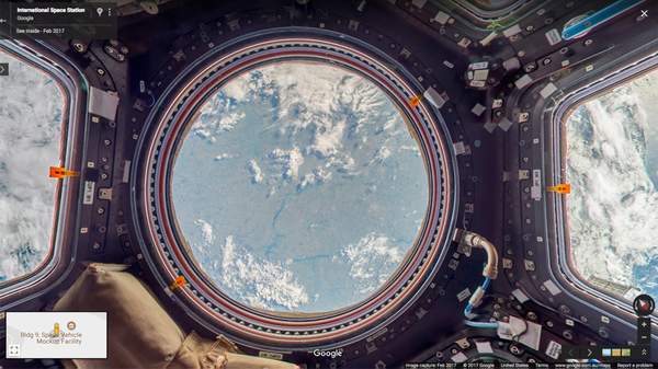
Launched on the 48th anniversary of the first manned moon landing, the virtual leap for mankind lets users explore all 15 of the ISS's interconnected modules, which orbit the planet more than 400 kilometres above the surface. From peering through the observational node to entering the airlock, pretending that you're living out your science-fiction dreams — and experiencing what it's like to literally look down on the rest of us, too — is now as easy as moving your cursor and clicking your mouse.
Obviously, you can't send Google's Street View car fleet into space, so the company worked with NASA bases and ISS astronauts to capture imagery from the inside the structure. DSLR cameras and equipment already on board were used to collect pictures in gravity-free conditions. The resulting snaps of the habitable artificial satellite were then sent back down to earth, stitched together and turned into panoramic shots.
If that sounds a little tricky, that's because it was. As European Space Agency astronaut Thomas Pesquet explains in a blog post for Google, "there are a lot of obstacles up there, and we had limited time to capture the imagery, so we had to be confident that our approach would work." Still, for anyone who has ever wanted to take a trip into space — but found costs, logistics, training and a whole long list of other factors getting in their way — it was worth it.
Explore the International Space Station on Google Maps.
Via The Verge. Image: Google Maps.
