Overview
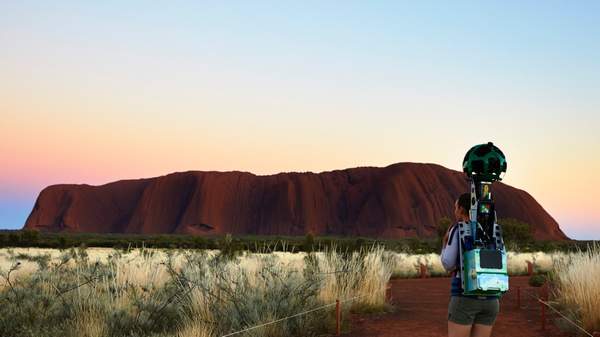
Those lucky enough to visit Uluru — to both get out to the remote location and to be granted generous permission to the sacred site by its traditional owners, the Anangu people — will attest to its magic and sheer magnificence. But for those who can't make it to the Red Centre, Google has made it possible to explore the area via the internet — today they've added a number of 360-degree images of trails from the surrounding Uluru-Kata Tjuta National Park to Google Street View.
By now Google has mapped most major cities and landmarks around the world, but in the case of Uluru, they've taken a bit of a different approach. Over the past two years, the tech company has worked with the Anangu people to capture and map the park in accordance to Tjukurpa, a traditional deep respect for the land that guides their law, values and behaviour. This means that not everything in the park has been captured by the Google Trekker, and that the traditional owners feature heavily in the project — most notably through interactive audio-visual stories on Google's Story Spheres platform. These include narration by Sammy Wilson and music by elder Reggie Uluru, both of whom are traditional owners of the land.
So what can you see? Well, you can catch a glimpse of Uluru on the horizon from the Talinguru Nyakunytjaku viewing area, 'walk' around the base of the landmark and do the Kuniya Walk, which will take you to waterhole Kapi Mutitjulu and let you get up close to ancient art at Kulpi Mutitjulu (the Family Cave). The content captured by Google is a rare chance to see the crevices and fine details of Uluru up-close and hear oral stories from the traditional owners of the land.
You can explore Uluru through Google Street View here, and listen to the Anangu people's stories through Story Spheres here.
