This Interactive Map Shows Victoria's COVID-19 Cases by Local Government Area and Postcode
The state-wide map lets Victorians see which areas currently have COVID-19 cases.
Before 2020 became a thing of the past, Victoria's 61-day run of no new locally acquired COVID-19 cases also came to an end, and new mask requirements and gathering restrictions were introduced. The state presently has 38 active cases at the time of writing on Tuesday, January 5, and the Victorian Department of Health and Human Services (DHHS) is continuing to release updates regarding new numbers — and it's updating its map of the confirmed cases broken down by area, too.
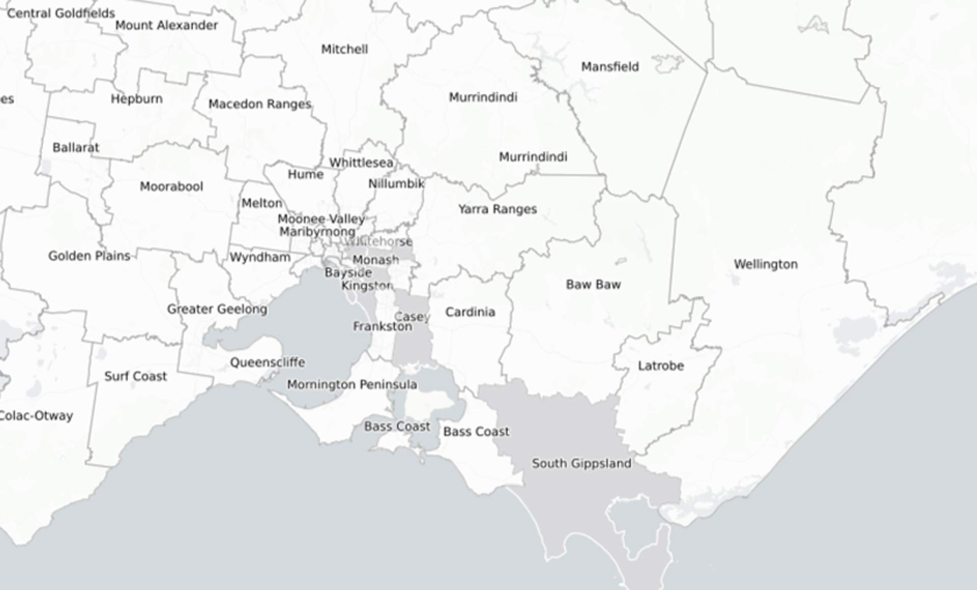
In 2020, DHHS released an interactive daily report of COVID-19 in the state, with a daily updated map as well. That system has undergone a bit of a revamp, but Victorians will still find the details they're looking for. Live on the DHHS website, the state-wide map now provides two options: confirmed cases by local government area, and by postcode.
Thanks to a handy colour code, it's easy to see which parts of the state have active COVID-19 cases at present. Regions without any cases remain white in colour on the map, while shades of grey get darker depending on the numbers in each particular area.
For example, if you're viewing by local government area, Monash, Booroondara, Glen Eira, Bayside, Kingston, Casey, Whitehorse and Maroondah all have cases as of 11.33am on Tuesday, January 5. By postcode, 3192, 3193, 3914, 3204, 3168, 3169, 3124, 3132 and 3136 are all on the list.
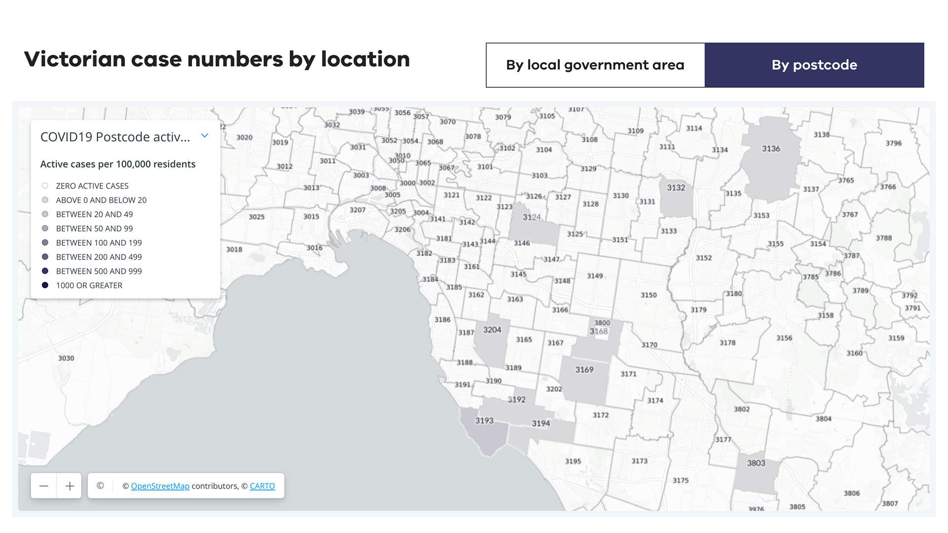
If you click on a specific local government area or postcode, you can also see the population, the active rate per 100,000 population, the total number of COVID-19 cases in the area during the pandemic, the current active cases and the number of new cases in the past 24 hours.
Scroll down on the same webpage, and you can view a state-wide breakdown of the cases by age group and sex, as well how the cases were acquired. And, you can drill down into the data yourself, with .CSV files available for download as well.
DHHS is also frequently updating its list of exposure sites, which is broken down into groups depending on the action needed. Some require anyone in the vicinity at specified times and dates to get tested immediately and quarantine for 14 days from the exposure, others require folks to get tested immediately and then quarantine until you receive a negative result, and a third category asks people to monitor for symptoms and, if any develop, to get tested immediately and isolate until you receive a negative result.
At the moment, gatherings at private homes in Victoria are limited to 15, and masks are mandatory in all indoor settings — except from when you are eating and drinking.
To find out more about the status of COVID-19 in Victoria and have a look at the interactive daily report, head to the Victorian Department of Health and Services website.
Top image: the DHHS Coronavirus COVID-19 in Victoria map as of 12pm on Thursday, January 7.


