Incredible Maps Depicting Human Activity
Modern digital technology allows us to produce and manipulate visual representations of geography in simply astounding ways.
Ever since cartography was first used in Ancient Babylonia in 2300BC, humans have relied on cartography to navigate, utilise, conceptualise and define geographical space. Modern digital technology allows us to produce and manipulate visual representations of geography in astounding ways, no longer limited to just geography.
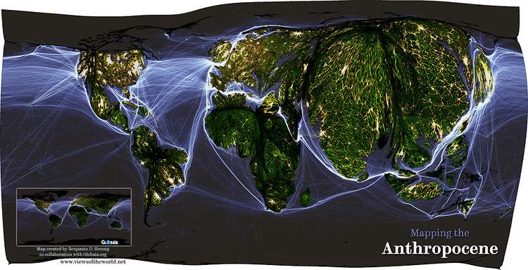
Benjamin Hennig at the University of Sheffield has created a series of innovative cartograms which illustrate new ways of seeing the planet, transforming our preconceptions of space and human impact.


The population distribution of the globe, with the more densely populated areas such as Central Asia appearing much larger in comparison to the insignificant size of Australia.
![]()
![]()
The world's major nuclear forces.

The world's poorest health systems.

The world's biodiversity hotspots.

Explosive Remnants of War (ERW) and Cluster Submunition Casualties in 2010.

Immigration to countries around the world (which really puts the debate in Australia into perspective).


- The Ten Best Hotels in Brisbane
- The Best Glamping Sites Around Australia
- Predicting the Oscars: Who Should, Could and Will Win at the 2025 Academy Awards
- Ten of the Most-Unique and Relaxing Stays You Can Book Around Auckland
- Unique Stays with Breathtaking Views of New Zealand's South Island
- The Most-Impressive Group Stays You Can Book in Byron Bay