Bruce Myren’s Inspired 40th Parallel Photo Series
The 40th parallel is much more than simply a line of latitude spanning the distance of America from East to West.
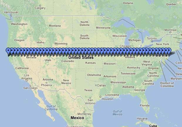
The 40th parallel is much more than simply a line of latitude spanning the distance of America from East to West; and Bruce Myren's photographs of it are much more than just photos. The line N 40° 00' 00'' bisects the country from New Jersey's shore crossing through Pennsylvania, Ohio, Indiana, Illinois, Missouri, over the border between Nebraska and Kansas, following on past Colorado, Utah, Nevada and finally finishing in California.
Myren is not only capturing the stunning surroundings of these landscapes, but is trying to understand and portray the "human desire to create systems and then locate ourselves within them". The fortieth parallel north is a tool for measurement, as well as acting as the baseline for creating homesteads and townships, functioning as a useful marker during Western settlement.
The project began as a fairly small and basic undertaking, using maps to identify the areas because GPS's were not widely available during that time. However, as geographical technology began to grow and develop, so too did Myren's photo series.
Using an 8 x 10 Deardoff camera and colour transparency film, Myren produced panoramas by snapping three shots moving from left to right then adding them together during editing. The photographer is aiming to take a landscape panorama shot at every longitudinal point along the line, adding up to a total of 52 locations and images, spaced roughly 53 miles apart from each other. So far he has captured 28 stunning images of these locations. Here are 10 of the inspired images from his series, aimed to make you "consider the history of landscape photography, American development , but most importantly [your] own relationship to place."


N 40° 00' o0'' W 109° 00' 00", Rangely, Colorado, 2000

N 40° 00' 00" W 108° 00' 00", Meeker, Colorado, 2000

N 40° 00' 00" W 101° 00' 00", Ludell, Kansas, 2011

N 40° 00' 00" W 98° 00' 00", Webber, Kansas, 2007

N 40° 00' 00" W 97° 00' 00", Hollenberg, Kansas, 2007

N 40° 00' 00" W 95° 00' 00", Fillmore, Missouri, 2007

N 40° 00' 00" W 93° 00' 00", Winigan, Missouri, 2011

N 40° 00' 00" W 81° 00' 00", Belmont, Ohio, 1999

N 40° 00' 00" W 76° 00' 00", Gap, Pennsylvania, 1999

N 40° 00' 00" W 74° 03' 32", Normandy Beach, New Jersey, 1998


- Dark Arts, Hedonism and Exploration: A Weekender's Guide to Visiting Hobart for Dark Mofo
- The Best Australian Fashion Brands to Know Right Now
- CP Picks: The Best Gifts for People Who Are Never Home — According to Travel Writers
- The Ten Best Hotels in Brisbane
- The Nine Best Coastal Spots for Whale Watching Across Australia
- The Best Pubs in Brisbane for 2026