Cartographica: Sydney on the Map
Explore the beautiful historical maps of Sydney.
In partnership with ![]()
![]()
Overview
Next time you're around Circular Quay, pop into Customs House and you'll find an exhibition of maps that have defined and guided people around Sydney for hundreds of years.
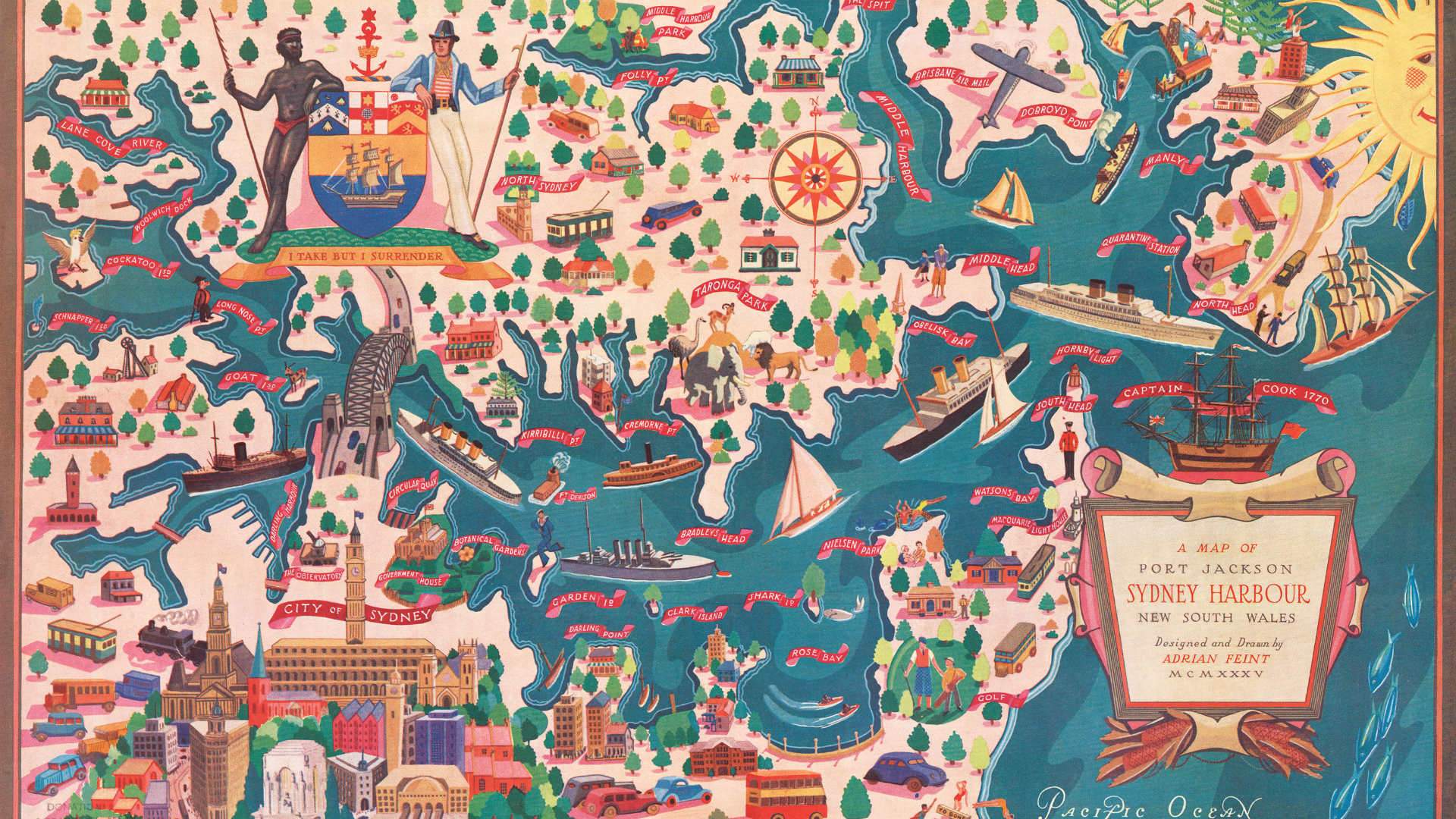
Cartographica: Sydney on the Map throws up ideas around maps and the way their creation and use continues to shift and change. Until satellite technology, people relied on different kinds of maps — following patterns of the land, the stars and the wind. For tens of thousands of years, the Gadigal people and surrounding Eora Nation clans navigated this region's waterways, bush and land, and in more recent times, the area that's now known as Sydney was mapped by Europeans and photographed from space. And today, we're all accustomed to the instantly recognisable voices of Siri and Google navigating us to places in our cars and seeing ourselves as a blue dot moving through a landscape of pixels.
Cartographica offers a mini retrospective of what analogue maps used to look like, some of the different ways mapmakers have documented the evolution of places and journeys over time and how simultaneously familiar and strange the world of digital maps can be. It's bound to be an eye-opening visit — and it's completely free. If absorbing all of this has left you feeling peckish, combine your visit with a bite to eat at Cafe Sydney or Quay Bar.
Cartographica: Sydney on the Map is open Monday–Friday, between 10am–7pm, and Saturday–Sunday, between 11am-4pm, until Sunday, September 1.


